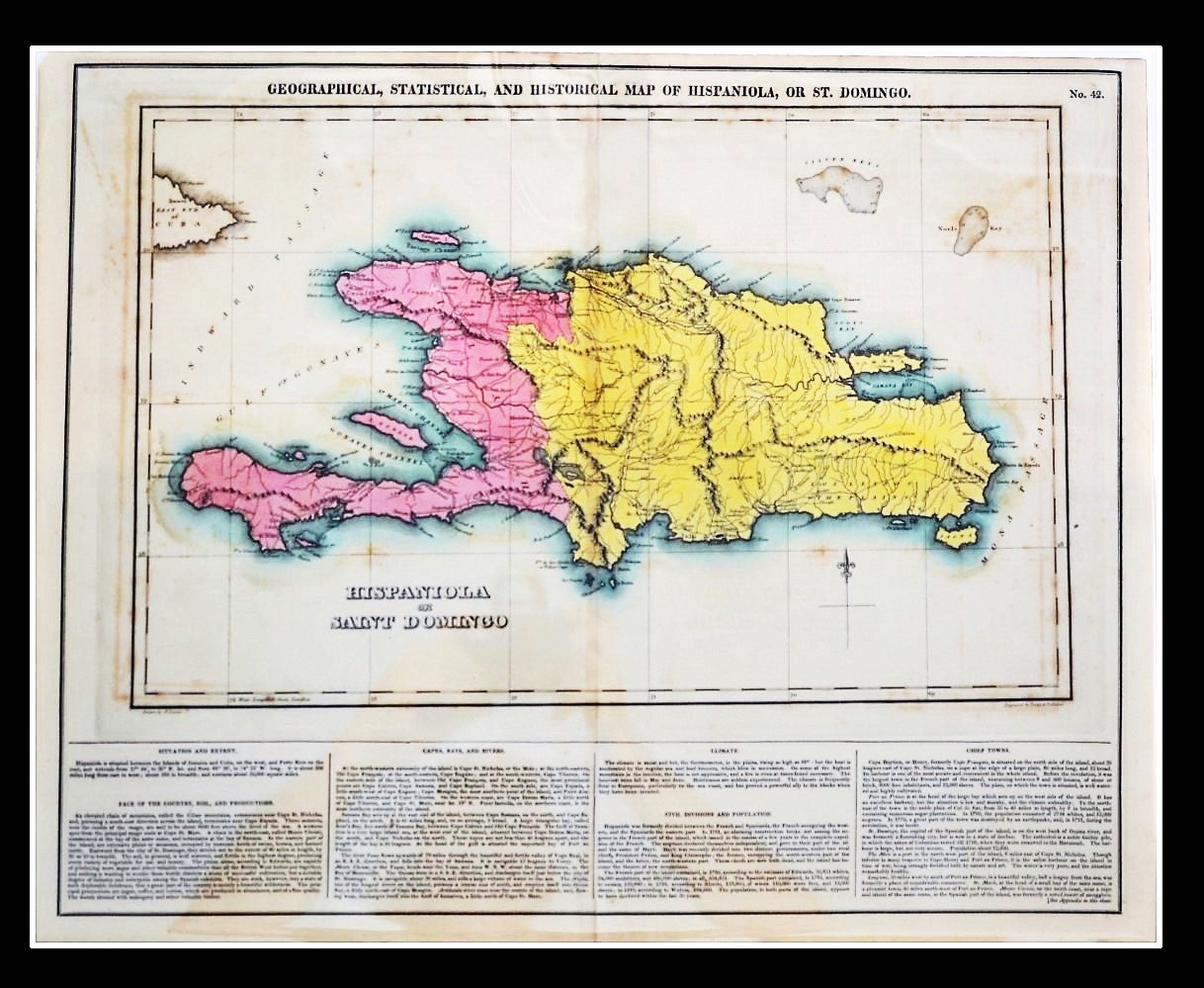
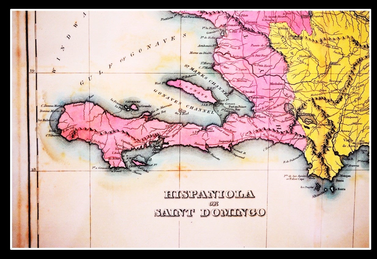
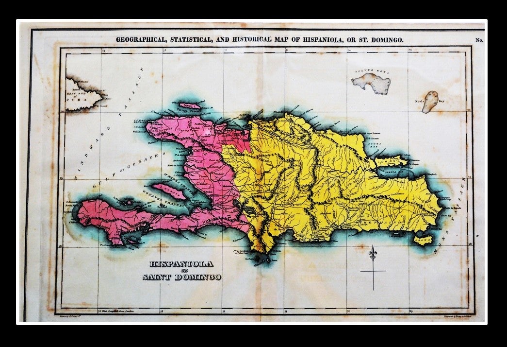
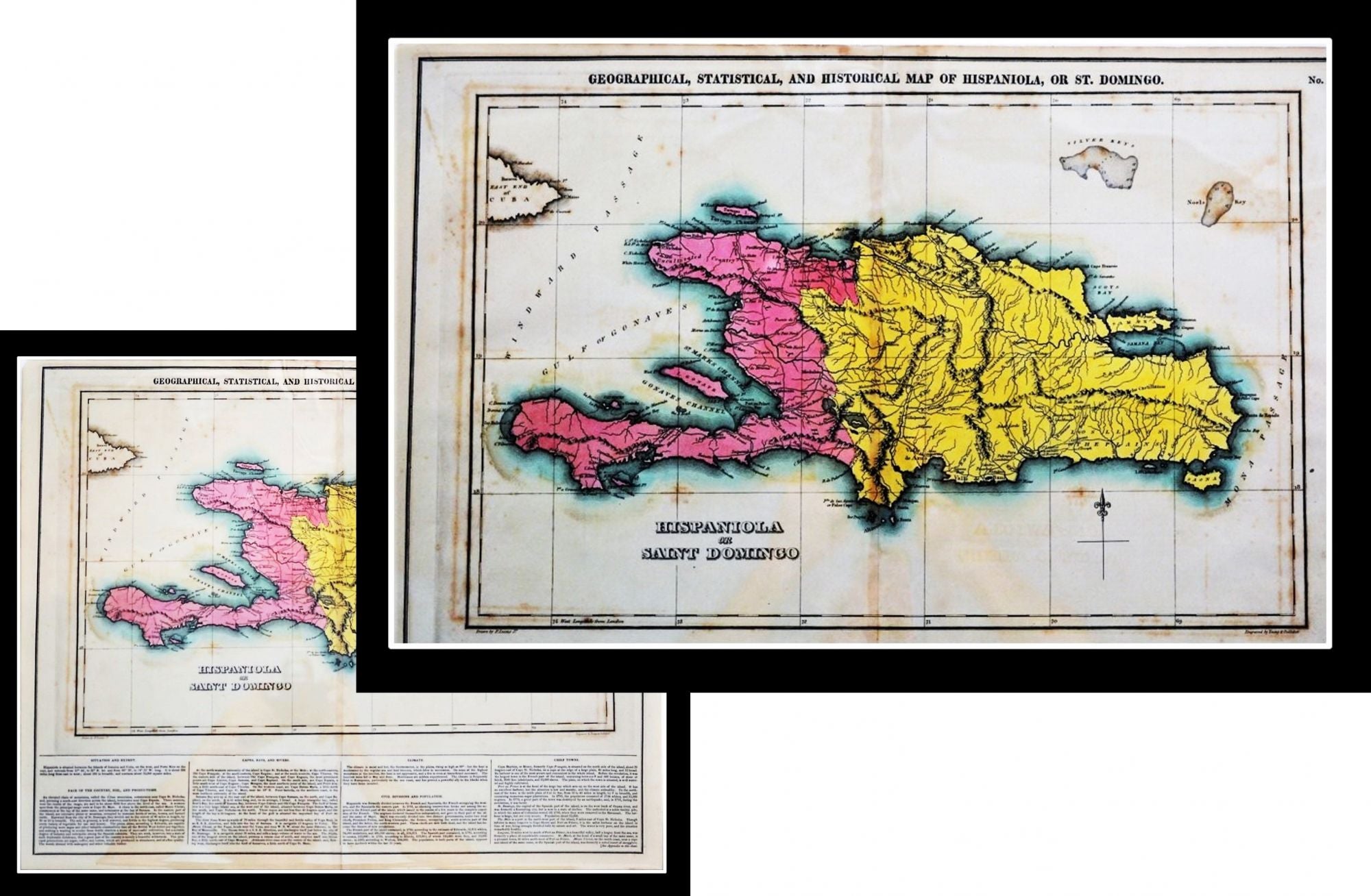
Geographical, Statistical, and Historical Map of Hispaniola, or St. Domingo.
Philadelphia: Published by Carey & Lea. c.1822. Fielding Lucas, Jr.
A Hand-colored Map from Carey and Lea's "A Complete Historical, Chronological, and Geographical American Atlas." In Fine condition.
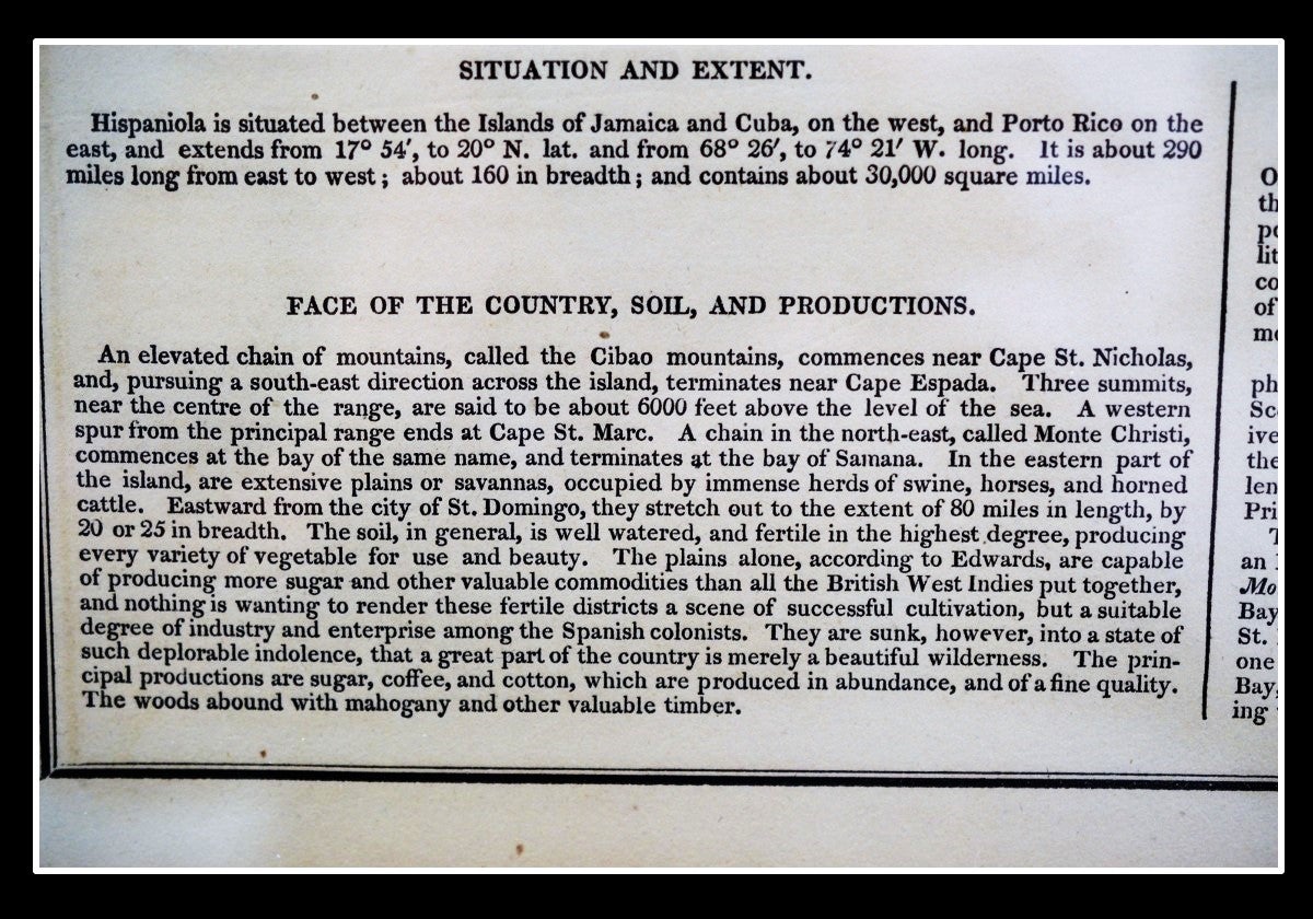
The text describes the boundaries, climate, rivers, chief towns, civil divisions and population. The map was drawn by F. Lucas Jr. and engraved by Young & Delleker.
A nice, bright impression with typical age toning. Measures: 16.5 x 20.5 inches (420 x 518 mm) including text, plus margins.
Very Good. Item #010803
"The best atlas of early nineteenth century America."
With the French part of the island, to the west, shown in pink and the Spanish part in yellow. With the history of unrest on the island described in the text below the map: "Hayti (sic) was recently divided into two distinct governments, under tow rival chiefs, president Petion, and king Christophe; the former, occupying the south-western part of the island, and the latter, the north western part. These chiefs are now both dead, and the island has become the theatre of new revolutions.
Publication Reference: P1373a; Howes C133, Rumsey
Price: $165.00
Other books you may like