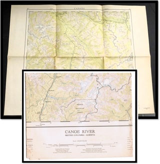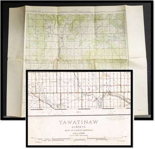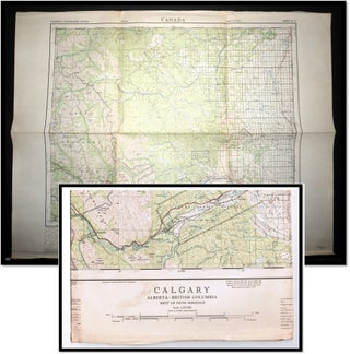
Topographical Map: Calgary Alberta-British Columbia West of the Fifth Meridian. 1959. National Topographic System Sheet 82-O.
Ottawa, Canada: Dept. of Energy, Mines and Resources, 1959. First Edition. Folded Map. Part of a series of 1:250 000 scale colour maps covers the provincial extent of Alberta and is comprised of 50 maps that are individually named using the National Topographic System (NTS) map sheet identifier. These maps.....