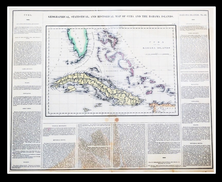
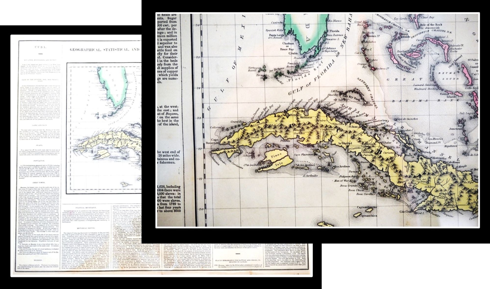
Geographical, Statistical, and Historical Map of Cuba and The Bahama Islands
Philadelphia: Published by Carey & Lea, 1822. Drawn by Fielding Lucas, Jr. (1781-1854).
A map from Carey and Lea's A Complete Historical, Chronological, and Geographical American Atlas.
The map was drawn by F. Lucas Jr. and engraved by Young & Delleker. The full sheet measures 22 by 17.5 inches. The actual map is16.5 by 12 inches. A nice, bright impression with typical age toning two dark spots centered just below the map border.
Very Good. Item #010805
Carey & Lea's Atlas is highly prized not only for its cartographic information but the marvelous information about each of the states and territories which is included. The atlas was issued in 6 editions in English, French & German between 1822 and 1827.
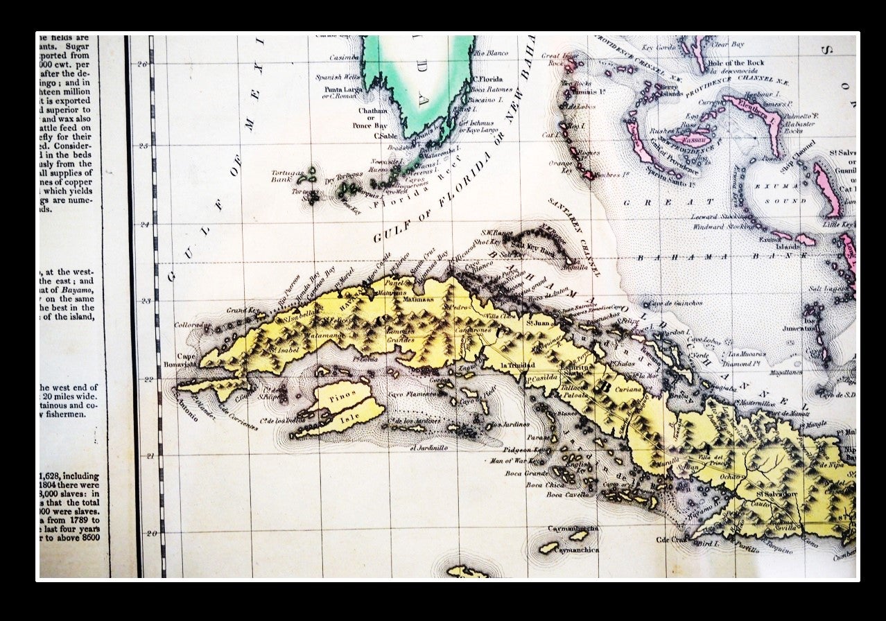
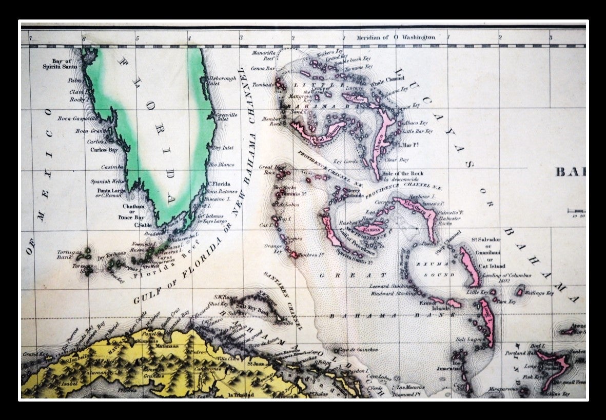
This dramatic map of Cuba and the Bahamas provides an intriguing geographic and political overview of the Caribbean islands. Historically, at the time of publication, Cuba, still subjugated under Spanish colonial oppression, was beginning to embrace independence established by the successes of Bolivar in South America.
The Bahamas was still under British colonial rule and a haven for escaped slave from the Florida. The site of Columbus' landing in 1492 is noted on Cat Island.
Navigational hazards, sand banks, and pictorial topography highlighting Cuba's rugged and mountainous interior are also shown. The map demonstrated the interconnection of these West Indian islands.
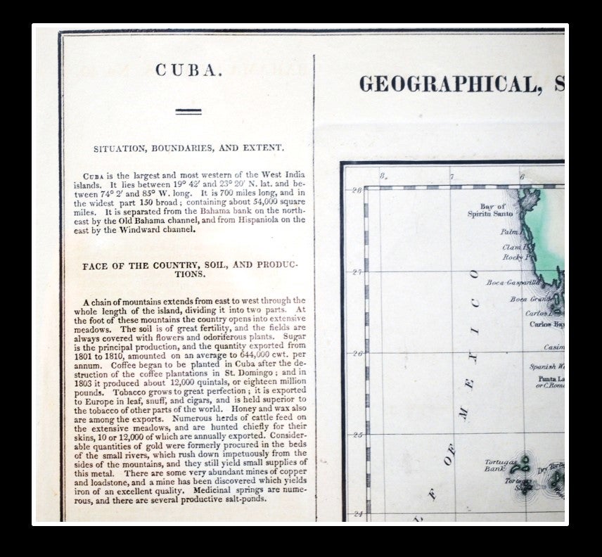
Surrounding the image are numerous paragraphs of text detailing the region's geography, climate, political organization and history.
Considered the best Western Hemisphere atlas of nineteenth century America the publication was issued in six separate editions and three different languages between 1822 and 1827.
The inspiration of the atlas's style of a map surrounded by blocks of informative text and tables of statistics was copied from an earlier European atlas by Emmanuel Las Cases [A. Lesage]
This and the other maps in the atlas were issued at a time of political upheaval in the Americas, and the detailed maps accompanied by extensive text provide a unique, often insightful, perspective on the problems and possibilities.
REF P1373a; Howes C133, Rumsey; CM1794.
Price: $165.00
Other books you may like