![Item #15382 This is England. Map of the Associated British and Irish Railways [1939]](https://blindhorsebooks.cdn.bibliopolis.com/pictures/15382.jpg?width=768&height=1000&fit=bounds&auto=webp&v=1649525975)
![This is England. Map of the Associated British and Irish Railways [1939]](https://blindhorsebooks.cdn.bibliopolis.com/pictures/15382_2.jpg?auto=webp&v=1649525975)
![This is England. Map of the Associated British and Irish Railways [1939]](https://blindhorsebooks.cdn.bibliopolis.com/pictures/15382_3.jpg?auto=webp&v=1649525975)
![This is England. Map of the Associated British and Irish Railways [1939]](https://blindhorsebooks.cdn.bibliopolis.com/pictures/15382_4.jpg?auto=webp&v=1649525975)
![This is England. Map of the Associated British and Irish Railways [1939]](https://blindhorsebooks.cdn.bibliopolis.com/pictures/15382_5.jpg?auto=webp&v=1649525975)
![This is England. Map of the Associated British and Irish Railways [1939]](https://blindhorsebooks.cdn.bibliopolis.com/pictures/15382_6.jpg?auto=webp&v=1649525977)
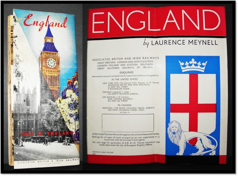
This is England. Map of the Associated British and Irish Railways [1939]
Stapled Wraps. This is England Map of the Associated British and Irish Railways
Published by the British and Irish Railways; 1939
Only 3 university copies located OCLC/WorldCat. Illustrated with photographs.
Stapled wraps showing routes from Paris through northern Scotland with an inset map of Ireland. 9.25 by 8 in 32-page illustrated tour booklet which folds to 9.25 by 4.25 in. Carefully handled, Text clean, Bindings tight.
Item #15382
Price: $19.95
See all items in
HISTORY,
TRAVEL, EXPLORATION & GEOGRAPHY
Other books you may like