![Item #15578 [World War II Occupation] City Map Central Tokyo 1948. US Far East Command.](https://blindhorsebooks.cdn.bibliopolis.com/pictures/15578.jpg?width=768&height=1000&fit=bounds&auto=webp&v=1652990683)
![[World War II Occupation] City Map Central Tokyo 1948](https://blindhorsebooks.cdn.bibliopolis.com/pictures/15578_2.jpg?auto=webp&v=1652990683)
![[World War II Occupation] City Map Central Tokyo 1948](https://blindhorsebooks.cdn.bibliopolis.com/pictures/15578_3.jpg?auto=webp&v=1652990683)
![[World War II Occupation] City Map Central Tokyo 1948](https://blindhorsebooks.cdn.bibliopolis.com/pictures/15578_4.jpg?auto=webp&v=1652990683)
![[World War II Occupation] City Map Central Tokyo 1948](https://blindhorsebooks.cdn.bibliopolis.com/pictures/15578_5.jpg?auto=webp&v=1652990683)
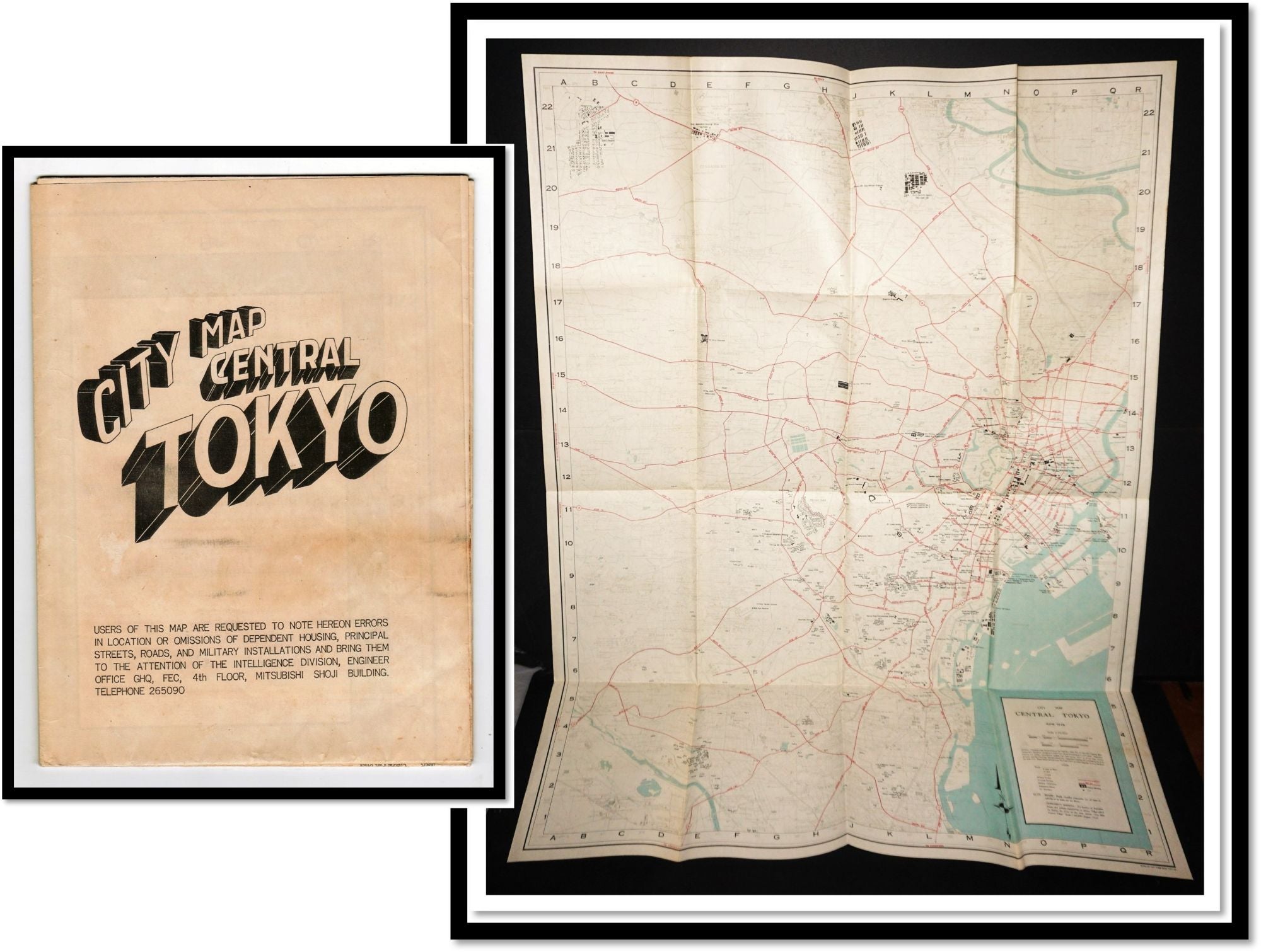
[World War II Occupation] City Map Central Tokyo 1948
[Toyko]: [Government Printing Office], 1948. Folded Map.
No flaws to the map but age-toning on the two panels that are exposed. Folded the map measures 7 by 9.5 inches. Scale 1:25,000. Opened 36 by 27 inches.
Two sided with the map on one side and a list of the many hundred locations on the other. The map contains directions for use. Compiled in 1948 from aerial photography by USAF 1947
There are only 11 copies of this map in institutions. (another similar, perhaps the same, is in three institutions) [OCLC / Worldcat]
Prepared under the direction of the Engineer, GHQ, FEC ; by the 64th Engineer Base Topographic Battalion especially for Dependents and Allied Military Forces stationed in Toyko
The Dependent Houses and Allied Installations are designated in Black on the face of the Map. Each dependent house is shown by a black square with the corresponding Name of the Building.
The Central business district of “Marunouchi District is shown on an Enlarged Scale on the Back of the Map as an insert. The principle streets and Numbered Routes are indicated by a Red Center Line and Lettered of Named.
Item #15578
Price: $195.00
Other books you may like