![Item #21862 Egypt and the Sudân: Handbook for Travellers [Sixth Remodelled Edition] [24 Maps, 76 Plans, 57 Vignettes] [Classic Red Cloth]. Karl Baedeker, Publishers Firm.](https://blindhorsebooks.cdn.bibliopolis.com/pictures/21862.jpg?width=768&height=1000&fit=bounds&auto=webp&v=1776326194)
![Egypt and the Sudân: Handbook for Travellers [Sixth Remodelled Edition] [24 Maps, 76 Plans, 57 Vignettes] [Classic Red Cloth]](https://blindhorsebooks.cdn.bibliopolis.com/pictures/21862_2.jpg?auto=webp&v=1776326194)
![Egypt and the Sudân: Handbook for Travellers [Sixth Remodelled Edition] [24 Maps, 76 Plans, 57 Vignettes] [Classic Red Cloth]](https://blindhorsebooks.cdn.bibliopolis.com/pictures/21862_3.jpg?auto=webp&v=1776326194)
![Egypt and the Sudân: Handbook for Travellers [Sixth Remodelled Edition] [24 Maps, 76 Plans, 57 Vignettes] [Classic Red Cloth]](https://blindhorsebooks.cdn.bibliopolis.com/pictures/21862_4.jpg?auto=webp&v=1776326194)
![Egypt and the Sudân: Handbook for Travellers [Sixth Remodelled Edition] [24 Maps, 76 Plans, 57 Vignettes] [Classic Red Cloth]](https://blindhorsebooks.cdn.bibliopolis.com/pictures/21862_5.jpg?auto=webp&v=1776326194)
![Egypt and the Sudân: Handbook for Travellers [Sixth Remodelled Edition] [24 Maps, 76 Plans, 57 Vignettes] [Classic Red Cloth]](https://blindhorsebooks.cdn.bibliopolis.com/pictures/21862_6.jpg?auto=webp&v=1776326194)
![Egypt and the Sudân: Handbook for Travellers [Sixth Remodelled Edition] [24 Maps, 76 Plans, 57 Vignettes] [Classic Red Cloth]](https://blindhorsebooks.cdn.bibliopolis.com/pictures/21862_7.jpg?auto=webp&v=1776326327)
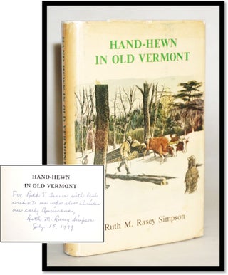
Egypt and the Sudân: Handbook for Travellers [Sixth Remodelled Edition] [24 Maps, 76 Plans, 57 Vignettes] [Classic Red Cloth]
Leipsic: Karl Baedeker, 1908.
A landmark volume in the Baedeker series, representing the first remodelled edition to fully integrate the Sudan following the regional stabilization of the early 20th century.
This sixth edition was a massive undertaking, replacing the previous two-volume set with a single, highly dense handbook. It is celebrated for its inclusion of 57 vignettes (small architectural and cultural illustrations) alongside a formidable cartographic program. As a primary document of the Edwardian Golden Age of Egyptology, it offers a high-resolution snapshot of the Nile Valley, its monuments, and its burgeoning modern infrastructure just years before the discovery of Tutankhamun's tomb.
KEY FEATURES
+++ Visuals: Complete with 24 maps, 76 plans (including the large folding map of Egypt), and 57 vignettes illustrating Egyptian art and architecture.
+++ Binding: Original flexible red cloth with gilt-lettered spine and front cover; marbled edges and yellow silk ribbon marker.
+++ Content: Features an expansive 184-page introductory section covering Egyptian history, hieroglyphics, and religion. Includes new maps for Assuan (Aswan) and Khartoum.
+++ Imprint: Leipsic: Karl Baedeker; London: T. Fisher Unwin; New York: Charles Scribner’s Sons, 1908.
+++ Specs: 6.25 x 4.25 inches; clxxxiv, 439 pages + index.
CONDITION: Good. The bindings are tight and square. The internal pages are clean with light, even age-toning. The extensive map program, including the large folding Nile maps, remains fine and well-preserved. The red cloth shows moderate handling wear, consistent with a volume intended for field use, with frayed edges at the spine corners and light rubbing to the extremities. The gilt remains legible.
SCHOLARLY FEATURES
+++ Remodelled Accuracy: This edition benefited from the contributions of leading Egyptologists of the day, ensuring the "scientific" accuracy Baedeker was famous for.
+++ The Sudan Expansion: Documents the opening of the Sudan to general tourism, providing the first detailed Western maps of the region's post-colonial layout.
+++ Vignette Series: The 57 vignettes serve as a vital visual aid for identifying temple styles and hieroglyphic motifs.
HISTORICAL SIGNIFICANCE —
The 1908 Egypt is one of the most sought-after Baedekers because it marks the firm's transition into modern "integrated" travel. By merging Egypt and the Sudan into one volume and adding the vignettes, Baedeker created a tool that functioned as both a logistical map and a portable museum catalog.
For the historian, this is the Imperial Egypt—a record of the country under the height of British influence, documenting the railways, steamers, and grand hotels (like the Savoy and Shepherd's) at their most opulent.
SUBJECTS: Egyptology, Sudan, Nile Travel, Archaeology, Middle Eastern History, Cartography, Handbook, Atlas (Archaeological Plans), Travel Literature.
BIBLIOGRAPHIC REFERENCE: Hinrichsen E251.
Item #21862
Price: $125.00
Other books you may like